

Live monitoringReal operating interface
See the fleet move in real time
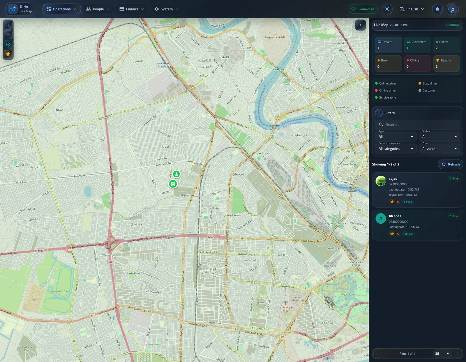
The map shows driver locations live and turns dispatch, connection state, and geographic zones into one operating view.
Interface preview
Interface language
Interface appearance
4 images
العربية / Lightالعربية / DarkEnglish / LightEnglish / Dark
LiveDriver locations
3Connection states
2Zone types
Operating flow
Locations and clear states
Driver locations appear with online, offline, or unknown state, alongside concise driver and customer counts.- Markers and colors explain every state
- Cards summarize active counts
- Unknown or disconnected drivers remain visible
- Jump to a selected driver or customer location
Live city operations map
The city view combines active drivers, customers, status counts, and a searchable entity list.Selected online driver
A live driver marker reveals availability and profile context at the current location.Driver fare context on the map
Selecting a driver exposes identity, state, vehicle, and current fare context without leaving the map.Selected online customer
A customer marker opens a compact identity and activity summary for live support work.Operating flow
Filters and fast navigation
Operators can isolate drivers by state or zone, jump to a selected zone, use current location, or fit every item in the map.- State and zone filters
- Bottom driver list for quick focus
- Current-location and full-map controls
Regional map and status filters
Region and connection-state filters narrow the live map and show a clear empty result when nothing matches.Operating flow
Zones in operating context
Service and blocked zones remain visible on the map so the team can review coverage and ride boundaries in the same place.- Service-zone layers
- Blocked-zone layers
- Jump directly to a selected zone
- Live context for dispatch decisions
Live monitoring